We decided to start the trip in Mesa Verde, CO. I hadn't been there since I was a kid, and Astrid had never been there. Since we were coming from a friend's wedding in Albuquerque, we arrived towards dusk. The fact that the campground was pretty expensive, coupled with the number of RVs that invade the landscape during the summer, forced us to seek a different place to grab a night of sleep.
We drove up a road towards Telluride and asked a couple of locals where a good place to lay down the bags would be. We ended up sleeping in one of the pleasant forests of quaking aspens that are so ubiquitous in the West. On the way into camp it was difficult not to notice the vast amount of irresponsible logging that had taken place. Entire forests lay waste to meadows, and large gashes were left in the earth from heavy machinery. Still, the landscape managed to retain its beauty.
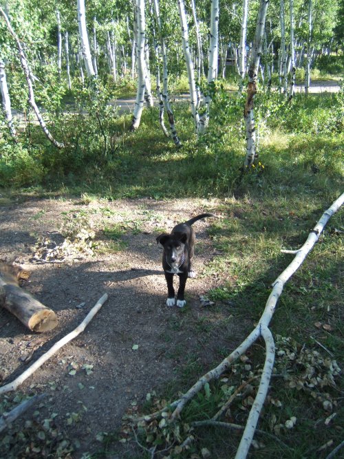
Since I'm talking about it, here's a picture of some random dog
that wanted to play in the aspens.
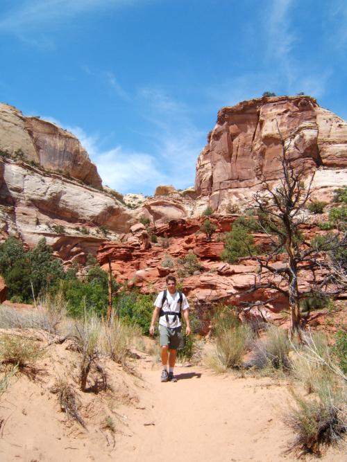
Anyway, we woke up early (early for us I guess) to hit Mesa Verde. Of course, we made good use of the National Parks pass. $50 gets us into any national park or monument in the country - a great deal. You actually have to wait in a (very) long line to get to see the cliff dwellings, but I must say that they are worth it. Overall, the park is well-run, but very busy. We took turns waiting in line while the other took the customary 3 bathroom breaks per hour. It has been said that I have a bladder the size of a walnut. Of course, I'm the one who says that, so the effect is somewhat weakened. Nevertheless, pressure downstairs is not acceptable. This was a particular problem while I lived in Europe, since there you actually have to PAY 50 cents or so to take a leak. I lived for a year in complete dehydration. As an aside, note that I took advantage of every outdoor free peeing cross ("gratis plassen-kruis") in Holland, just out of principle (and I have photographic proof of this).
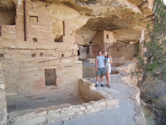
Here we are at the ruin of Balcony House. It is built literally into the side
of the cliff. The caves are naturally occuring when water seeps down from the top of the
mesa through the rock and erodes some of the weaker rock underneath. Note that this also
forms little pools at the floor of the caves - this must have been an excellent water
source for the dwellers. Of course, the park service has a huge set of stairs so that
any moron can get down there now, but in its time this must have been rather
imposing.
I suppose that the original dwellers were the so-called Anasazi (or Pueblo Indians). They would have grown their crops on top of the mesas (these mesas have long been taken over by junipers). Apparently they are descended from tribes further south in New Mexico and Arizona. For some unknown reason the dwellings became deserted rather suddenly - I think only being used for a couple hundred years. Theories abound, but nothing sounds very convincing.
I do think that it is interesting, however, that the Navajo word "Anasazi" literally means "Ancient Enemies". Ha, speculate on THAT! Anyway, our guide was a bit on the spiritual side, so she mostly talked about pseudo-native spirituality and the like. I would have much preferred a real archaeological discussion, but whatever "floats your boat" I guess.
While in Balcony house I noticed a retaining wall built right in the front of the dwelling. Since it was mortared in with what looked like cement, we thought that it was probably placed by the CCC in the 1930's for tourist safety. Still, it blended well with the archaeology, and I thought: at least the park service did a good job making this modern wall look authentic. Just then the ranger must have noticed that I was examining the wall because she noted that the wall was original and, in fact, unique in the cliff dwellings (and she also gave a sharp snap to a couple of kids who were sitting on it). The purpose of the wall was for a playpen of sorts... for children. Apparently there was a designated place for young children to play without worry of them wandering off the side of the cliff! Anyway, I think that they must have used ash as a major ingredient in their mortar. I'd be interested to learn of their construction process.
The original entrance was a small keyhole-like slot cave in the rock - one which we had to go through on our hands and knees. This would have made a good place to club any attacking enemies on the head I think. If the tribe could keep a good enough stockpile of food (and with plenty of water from the weeping rocks at the back of the cave), I think that it would be possible to hole up in these fortresses for a considerable length of time.
That brings me to the next ruin - Cliff Palace. This is the largest ruin in the park
(I think), but it was far more impressive from above then from inside. Here's a
picture:
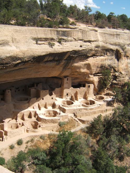
I was particularly impressed with the construction of the kivas - the round houses built into the ground as seen above. They would have been covered with a wooden roof and then clayed over, only leaving a small hole in the top as an entrance (requiring a ladder, of course) and a place for the smoke to go. Obviously they understood the principles of thermal mass. The kivas, built of stone and mud, would retain heat for a long period of time. Furthermore, the geothermal ground temperature would keep the kiva warm in the winter and cool in the summer (relatively - I'm guessing somewhere in the 60's Fahrenheit). There was a small keyhole in the side as an air inlet for the fire in the center. They placed a small baffle wall in front of the keyhole inlet to disperse the fresh air around the kiva. This would have gone a long way toward keeping uncomfortable drafts out of the place I think.
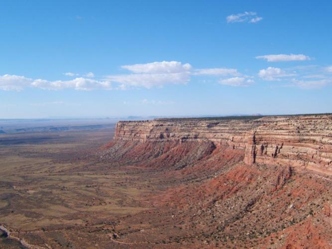
We were pretty satisfied, and decided to move on towards some places that are a little more out of the way. Mesa Verde was beautiful, but we needed some isolation. Since we were already in the general four-corners region, we decided next to go see Monument Valley down on the Utah-Arizona border. From Salt Lake, these parks are somewhat out of the way, and so I rarely get down to see this region (the region below Lake Powell). In fact, neither of us had ever been to Monument Valley.
We drove all day and slept off of a remote dirt road somewhere. This is our usual bit while driving when the weather isn't too difficult. Just plop the bags down and try to get a few hours of sleep. We set up shop next to an old cattle watering trough - long since rusted and the cattle disappeared.
It takes a lot of desert land to support cattle - the vegetation is sparse, and this vast emptiness had long since given up its meager yield. While falling into sleep, I noticed bats flying not more than a couple of feet over my head. Unlike the vultures that had once stocked me through a similar rogue night in New Mexico, waiting for my lonely body to give its last breath, these bats were welcome. They were probably keeping a myriad of insects away from my face. In the middle of the night we were awoken with a thunderous sound. Apparently, in this sparsely populated country, the military sees its way to treating the coyotes to the sonic boom which accompanies its test jets. I didn't mind since I've always liked planes, but I was amazed to see how quickly that bird streaked from horizon to horizon. I could still hear the engines from 100 miles away, a reminder that I'm living in a time when even the open country is marked by humans. Mischievous coyotes woke me up again before dawn - they were howling up a storm. I think they were fighting over some decaying scraps of flesh that happened to arouse their appetites. What the unfortunate animal was I do not know. For a brief flash I tried to recall if we had left any food exposed. As soon as my mind settled, I drifted back to sleep. I thought about those coyotes, and wished that I had been born in a time when the land was still unknown and rugged.
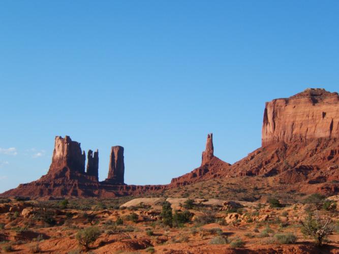
We popped up at dawn (it is impossible to sleep
after dawn - the sunrise
torches the red rocks and bathes the landscape in thermal light, like
some kind
of pristine hell). The air was fresh, and we made it to
Monument Valley not
long after sunrise:
But we're screaming at the wind here, since I'm sure that there are plans drawn up for a giant casino and possibly a power plant right in the middle of the monument. I'd hope that they'd put it right on top of those mesas... I mean, if you're going to do it, do it right. That's what I say, anyway.
This reminds me of one somewhat scandalous presence back in Mesa Verde. If you travel down one of the loops, deep into the park, you will notice that there is ONE SMALL CORNER of the Navajo reservation that barely glances the road - it's about the size of a house lot, and the reservation careens down the cliff directly behind it into the still-pristine wilderness beyond. Now the Navajos have really dressed the place up by putting a little micro-casino RIGHT IN THE MIDDLE OF THE NATIONAL PARK. I particulary thought that the cheap plastic beads made a wonderful juxtaposition against the ancient ruins. Furthermore, the ranger began her talk by emphasizing that we not only respect the physical, archaeological aspect of the ruin, but also to protect the spiritual side as requested by the natives. Those beads and fake feathers really drove the point home.
I digress. Needless to say, we preserved our $10 (each) and turned around, satisfied that we had seen the famous Monument Valley. As Ben Franklin noted, a penny saved is a penny earned. Or in this case, a cool $20. Now, if anybody ever starts talking about Monument Valley, I can safely say that, although providing a beautiful skyline, there are thousands of places that are more worth the time and effort. It's really something to see if you are in the neighborhood, not on a special trip. On the Spencer scale of spectacular Utah geology, I give it a solid 5 out of 10.
We still had the entire day ahead of us since we turned around from Monument Valley still rather early in the morning. We made our way up towards a small out-of-the-way park called "Valley of the Gods". These small remote areas almost always pay off high dividends. I am often amazed at being possibly the only human in thousands of square miles of open wilderness, each bit precious and unique, more beautiful than any man-made art. In the meantime, as I recall, there are people waiting in lines of a million long to see the postage stamp-sized Mona Lisa in the Louvre (OK, I did it, too... point taken). Let's keep it that way (wink).
We didn't go too far into the Valley of the Gods, but I can't remember the reason. Probably the midsummer heat changed our minds quickly. The place is a fiery furnace, and the unfortunate exposed individual will quickly give in to dehydration or worse. Needless to say, this is where the REALLY exposed part of our vacation began. It was a constant battle to hike enough water with us, even for rather short day hikes.
I usually camp in Southern Utah in the winter, and this trip was a good reminder of why the desert is really better for winter camping. The summertime heat is extreme. During the winter the story is completely different. First, the desert is far more beautiful in the winter - the contrast of snow against the red rock is spectacular. We have taken many trips over the past several winters to the red rock country, and each time seems more beautiful than the last. The sights in the desert make me feel at home and at peace, probably since it IS home.
Second, the desert population during the winter is usually very close to zero. There is really no better place to be alone than in the red rocks through the cold. I will admit that winter desert camping is hard - the nights are extremely cold (usually dipping down around zero degrees Fahrenheit), and thus good gear is required. This probably explains the low tourist population (and the almost non-existent backpacker/tent population, of which I'm proudly a member).
Anyway, leaving the Valley of the Gods, I could not see where the road
was going to take us. It appeared to disappear straight into the side
of a large cliff. Nevertheless, the small dirt road WAS drawn on the
map, so we continued. I did not see the road turn into switchbacks until
we were on top of them. From below I had no idea how the road was going
to go up these sheer walls, but IT DID! I was astounded! Just to prove
my point, here's a picture of the cliff that we drove up. The valley below
is the (boring part of, I'm afraid) Valley of the Gods.
That road led us through some of the most beautiful country that I've seen in a long time. Thoroughly deserted, I think the animals were not accustomed to any human presence. My evidence for this is the following: in all of the years of driving, never before have I hit one of those small birds that sit on the road. They always get out of the way in time. ALWAYS. Period.
I suppose that now I'm a micro-bird murderer.
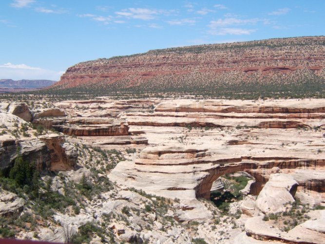
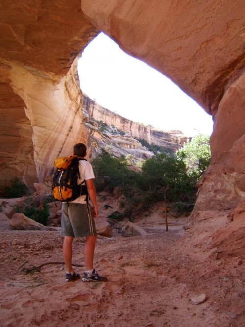
We drifted into Natural Bridges National Monument/Park about mid-afternoon. The place was somewhat sparsely populated, despite this being the high season. What a welcome peace of mind THAT was. Anyway, I really regret it now, but I neglected to get photos of the solar panel energy system that powers the park. It was rather impressive, and was one of the first of its kind in the 1980's. They had a HUGE array, and I dare say that I spent most of the afternoon in my thoughts, calculating power outputs and prices, equipment lifetimes and maintenance, etc. - all while still enjoying the spectacular scenery, of course.
We enjoyed Natural Bridges so much that we decided to stick around for a couple of days and get some hiking in. One of the rangers gave a small presentation on the power system during the evening. I suppose it was good for the layman, but I wanted to know somewhat specific things about the system. Of course, she didn't really know much about the system, so I left it alone. No point in being annoying. I don't blame her, though - I've been studying this sort of thing for years as a (more or less) serious hobby.
Natural Bridges is comprised of 3 (I think) major bridges. These lie within
formations that were/are being cut out by a river. The river was dry during
our visit, so we had the opportunity to hike along the bottom and visit all
3. Of course, there was a road along the top of the mesa that could get
the impatient visitor a look from above. Here's an image of the third bridge
from above - I forget the names of the bridges:
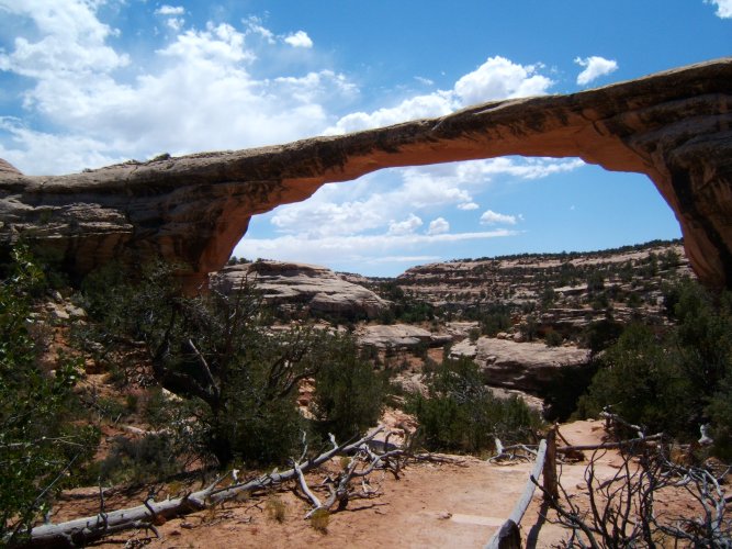
The hike along the bottom of the river was a total of 9 miles. We were supposed to park the car at the top, hike down from the first bridge to the third bridge, then hike out and walk back to the car along the top of the mesa (an extra couple of miles, but easier hiking). We thought there would be no problem - a simple day hike.
To prepare for the journey, we put on plenty of sunblock, covered up,
grabbed the sunglasses, and filled the backpack with a couple gallons of
water and a bit of lunch. Even this much water was not enough. Here's
the first bridge - beautiful:
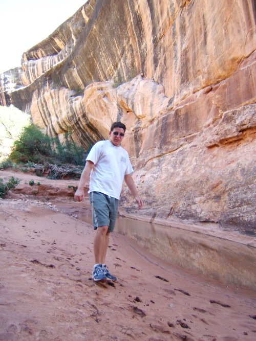
The trip along the bottom was very exposed and hot. We were completely
alone for the entire day down there - I suppose that the hike is a little
strenuous for most. To make matters
more difficult, the riverbottom was pure sand, making the hiking arduous.
Astrid took a big breather for lunch, and I didn't even push the issue.
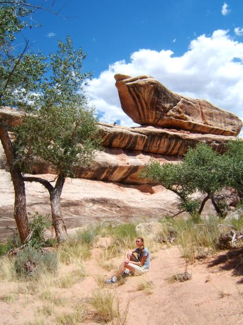
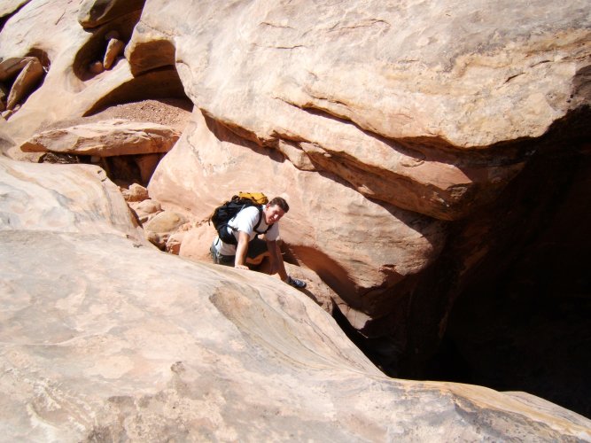
Towards the second bridge, we became a little lost on the exposed slabs of
rock. The cairns became unreliable, and we ended up going along the wrong
side of the riverbed. Here is a picture of where I (yes, I admit it) made
the fateful wrong choice.
After backtracking, we finally made it to the second bridge. It is at
this point that we are merely 6 miles into the journey
We decided to cut the hike short. We could get out of the canyon and hike along the mesa top at this point, making the trip only 2-3 more miles rather than 6-7 more miles. Being out of water and already dehydrated, the choice was obvious, although the hiking was still not easy. The mesa top was high and exposed - sparsely vegetated with juniper trees. Sometimes it's amazing to see where a hardy juniper tree will cling to life. Then I realize how many thousands of years old that tree is, and I have a little bit more respect for how I treat it.
We made it out of the canyon and headed back to obtain water. The park had put a ration of 5 gallons of water per person per day. The greedy RVs use this much to wash their tires, but going a little less fancy with a tent this did not put much limitation since our needs were so low. Still, I think that together we drank that river dry that afternoon.
We slept the night away and made our way out to cross Lake Powell (up far
enough to where it can still be called the "Colorado River" I suppose).
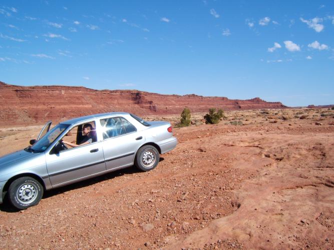
We found a tremendous-looking four-wheel-drive road that seemed to go
somewhere out of the way to a nice spot on the river. It was completely
deserted. The term four-wheel-drive rarely actually applies (to us), so we decided
to go for it (of course, we only drive on ROADS THAT EXIST. I think that
off-road driving is a sure sign of selfish white-trash breeding). Although
it doesn't look it in this picture, that road was quite rough and difficult.
Actually, to clarify, the riverbed decided to quit the game for us. We came to a point where the road turned to complete sand, so we decided to hike in the last mile or so. We eventually got to the riverbed - down a 20-foot cliff and as dry as a bone. I guess a four-wheel-drive with a set of helicopter rotors could actually make it to the lake from there.
Tired, dusty, and dehydrated, we were desperate to get to the river.
We drove out and continued on the road until we came to a bridge that
crosses the Colorado River proper. We couldn't fail this time. Let's
have a look from below:
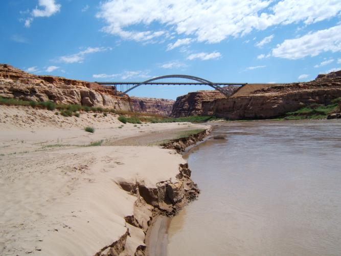
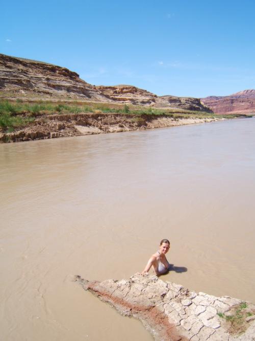
As usual I'm punished for not going to church. Not more than a mile down the road we found a perfectly wonderful place where the water serenely touches the shoreline, and most elderly and even some CORPSE-LY people could make it to the water. Oh yeah, and it wasn't muddy there, either. Well, we'd had enough of the water I think.
I couldn't keep my eyes open from all of the sunshine, so I
quickly drifted off into a deep sleep. OK, as deep as a sleep can
be in a moving car with light so bright that even the blind would be
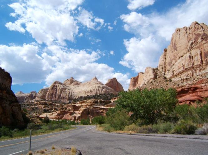
a little "put out". While I was out we drove through
Capitol Reef National Park. We
have seen it many times, but Astrid stopped anyway and managed to snap this
image. Personally
it is one of my favorite photos of the vacation, because it really
"says it all":
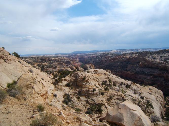
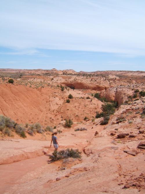
On to Calf Creek. This is a beautiful little spot in between Boulder
and Escalante, and the road is one of the most striking drives in Utah. This
image depicts a view from the road above the Calf Creek canyon
Here I am sitting around the campfire reading a copy of Mark Twain's
"Roughing It". We spent a fair amount of travel time reading aloud
from this novel, which was recommended to me by my good friend Larry Dunn
from the physics department in Texas. Now I'm recommending it to YOU!
(it actually took about 6 months to read, considering that it wasn't
finished by the time school started, and then it wasn't picked up until
school ended!)

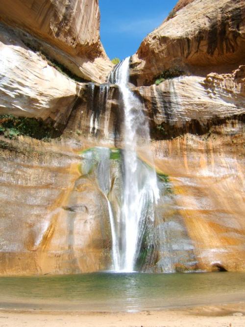
We hiked into the lower falls, which is a nice and easy trail. There
are several pictographs along the way of which to take notice
The falls themselves are incredible - we spent several hours in the
beautiful crystal-clear pools
But that was a delayed surprise, so we had still several more days to play. Near Escalante is a small state park which features a couple of miles of trails FILLED with petrified forest. It was incredible, especially because we were quite isolated. The landscape is dominated by ancient junipers, most being hundreds or thousands of years old, clinging to life in the barren soil. The petrified trees littered the ground everywhere, but they were from a time millions of years ago when the climate was very different. Instead of the harsh juniper forest presented to us, that place had once been a lush tropical forest, with gigantic trees that have long ago disappeared from existence.
It was unfortunately too dark to take pictures, so the next day we decided to spend some time in the Grand Staircase-Escalante National Monument. This is a GIGANTIC National Monument which takes up a huge portion of the lower corner of Utah. It is a new park, and is also quite isolated. Most of the attractions are 4-wheel-drive-only access, and hence we had plenty of time to ourselves out there. Let's hope that it stays that way.
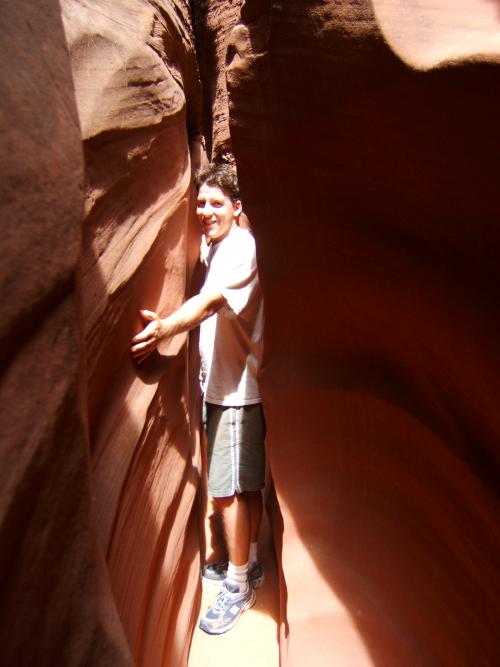
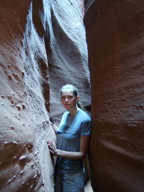
The weather was no problem, so we decided to visit a few of the
slot canyons down in the Hole-In-The-Rock area. Hiking down was
rather hot and exposed,
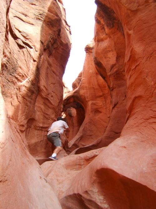
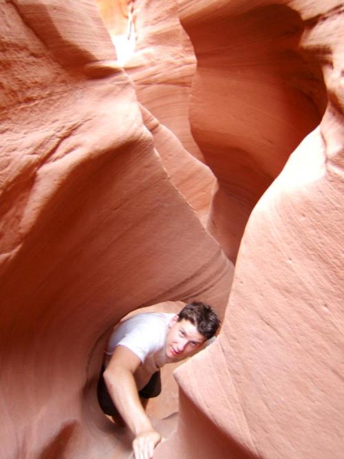
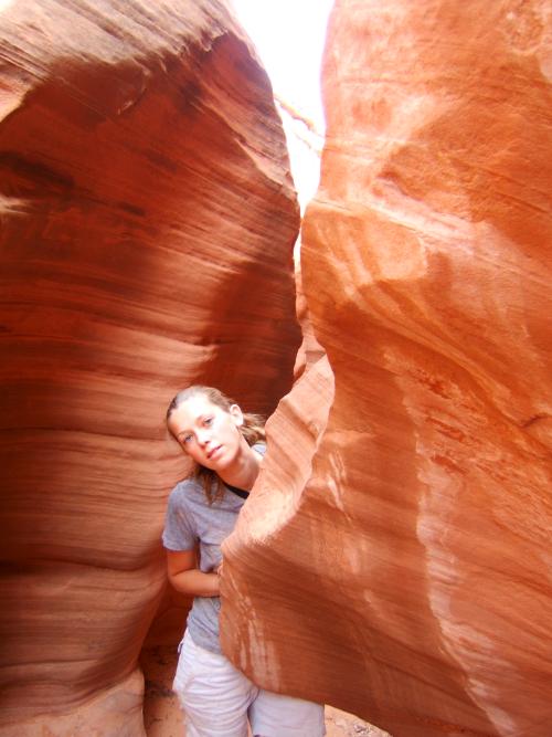
Here's a picture inside of the second slot canyon - Spooky
Finally satisfied, we pointed the little Kia towards Salt Lake and a shower. Goodbye to Southern Utah until winter?
This page has been visited times since January 13, 2005